


Peru Voting District, Chautauqua County, Kansas
About
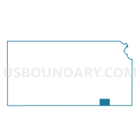
Outline

Summary
| Unique Area Identifier | 584164 |
| Name | Peru Voting District |
| County | Chautauqua County |
| State | Kansas |
| Area (square miles) | 30.37 |
| Land Area (square miles) | 30.16 |
| Water Area (square miles) | 0.21 |
| % of Land Area | 99.32 |
| % of Water Area | 0.68 |
| Latitude of the Internal Point | 37.06548440 |
| Longtitude of the Internal Point | -96.11736220 |
Maps


Graphs
Select a template below for downloading or customizing gragh for Peru Voting District, Chautauqua County, Kansas


Neighbors
Neighoring Voting District (by Name) Neighboring Voting District on the Map
- Voting District 101, Osage County, OK
- Chautauqua Voting District, Chautauqua County, KS
- Little Caney Township Voting District, Chautauqua County, KS
- South Sedan Voting District, Chautauqua County, KS
- Washington Township Voting District, Chautauqua County, KS
Top 10 Neighboring County Subdivision (by Population) Neighboring County Subdivision on the Map
- Pawhuska CCD, Osage County, OK (7,532)
- Sedan township, Chautauqua County, KS (1,435)
- Belleville township, Chautauqua County, KS (569)
- Little Caney township, Chautauqua County, KS (329)
- Washington township, Chautauqua County, KS (85)